Satellite technologies will help determine the site of one of the most important battles of antiquity
A research team of Polish scientists from the Jagiellonian University and the AGH University of Science and Technology in Krakow is looking for the site of one of the greatest battles of antiquity, in which Alexander the Great won a historic victory. They are supported by the latest satellite technology.
The research is funded by a grant from the National Science Center and is being carried out in what is now Iraq, in co-ohe cooperation with the Italian archaeological mission from the University of Udine. Satellite technologies play an important role in the implementation of research.
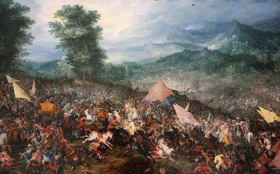
The legendary battle of antiquity
The Battle of Gaugamela, fought in 331. p.n.e. Between the Macedonian and Greek armies under the command of theoThe relationship between Alexander the Great and the Persian army commanded by King Darius IIIoDarius III, is described as one of the most important battles in the history of antiquity. It led to the collapse of the nearly two-hundred-year-old Persian empire and opened the door to a new era, commonly known today as the „Hellenistic period”. This one, on the other hand, has had a key impact on the cultural heritage of the middle worldosea and Middle East satellites. Despite the battle’s great significance, its exact location has not been confirmed. Finding the site was undertaken by Polish archaeologists.
– The goal of our project is to determine the exact location of the Battle of Gaugamela in light of multidisciplinary research, with particularoln particular, taking into account the methods of ancient history and landscape archaeology,” said Dr. Michał Marciak, project manager from Jagiellonian University. – Oprocz sourceoancient sources, archival and wspoIn our research we use remote sensing data, in this case images from satellitesoin earth observation – added.
Why satellite imagery?
In determining the location of the battle, optical satellite imagery of the high-resolution Pleiades constellation, owned by Airbus Defence and Space, is used. The imagery was provided by Astri Polska, an official distributor of satellite imagery and productow geoinformation products of the Airbus Group in Poland. As the company’s representatives emphasize, high-resolution satellite imagery may have a big advantage in this case over other ways of acquiring geographic information.
– Images taken via satellitesow can be delivered roalso for the areaoin, whichore due to the rohe different situations occurring on them, e.g. disasters, armed conflicts, are inaccessible to other technologies. In case you want to make similar depictions from the ceiling of e.g. aviation, obtaining images can be problematic,” said Michal Wyszynski, responsible for product distributionow geoinformation at Astri Polska. – What’s more, the Jagiellonian University chose for its research the images taken by satellite several years ago. The provision of such images was made possible by access to the Airbus Group’s archive of satellite imagery, dating back to 1986 – added by.
The growing interest in satellite data in Poland
More and more companies and institutions in Poland are recognizing the benefits of using satellite data. This trend is confirmed by the company Astri Polska. – In recent years, we have noticed a significant increase in the interest of Polish companies and institutions in the use of high-resolution commercial satellite imagery. They are finding applications in a growing number of fields of economics and science, such as water management
and land, precision agriculture, emergency management, goagriculture or environmental monitoring and protection – emphasized Michal Wyszynski of Astri Poland.
Sourceobackground: inf. press, fot. Jan Brueghel’s painting – Battle of Gaugamela